
River Data
River levels and flows for hunters
High water can cut off a creek crossing or flood the bottoms you planned to hunt. Hunting Points shows water levels and flows from more than 35,000 river stations worldwide.

Get the app on your phone
Scan the code with your phone's camera, or choose your store.
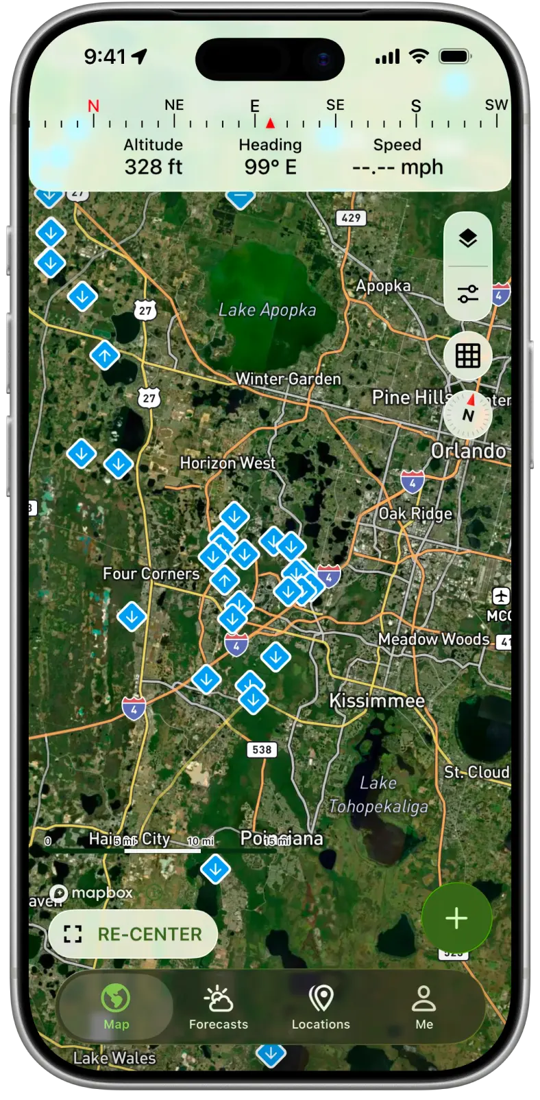
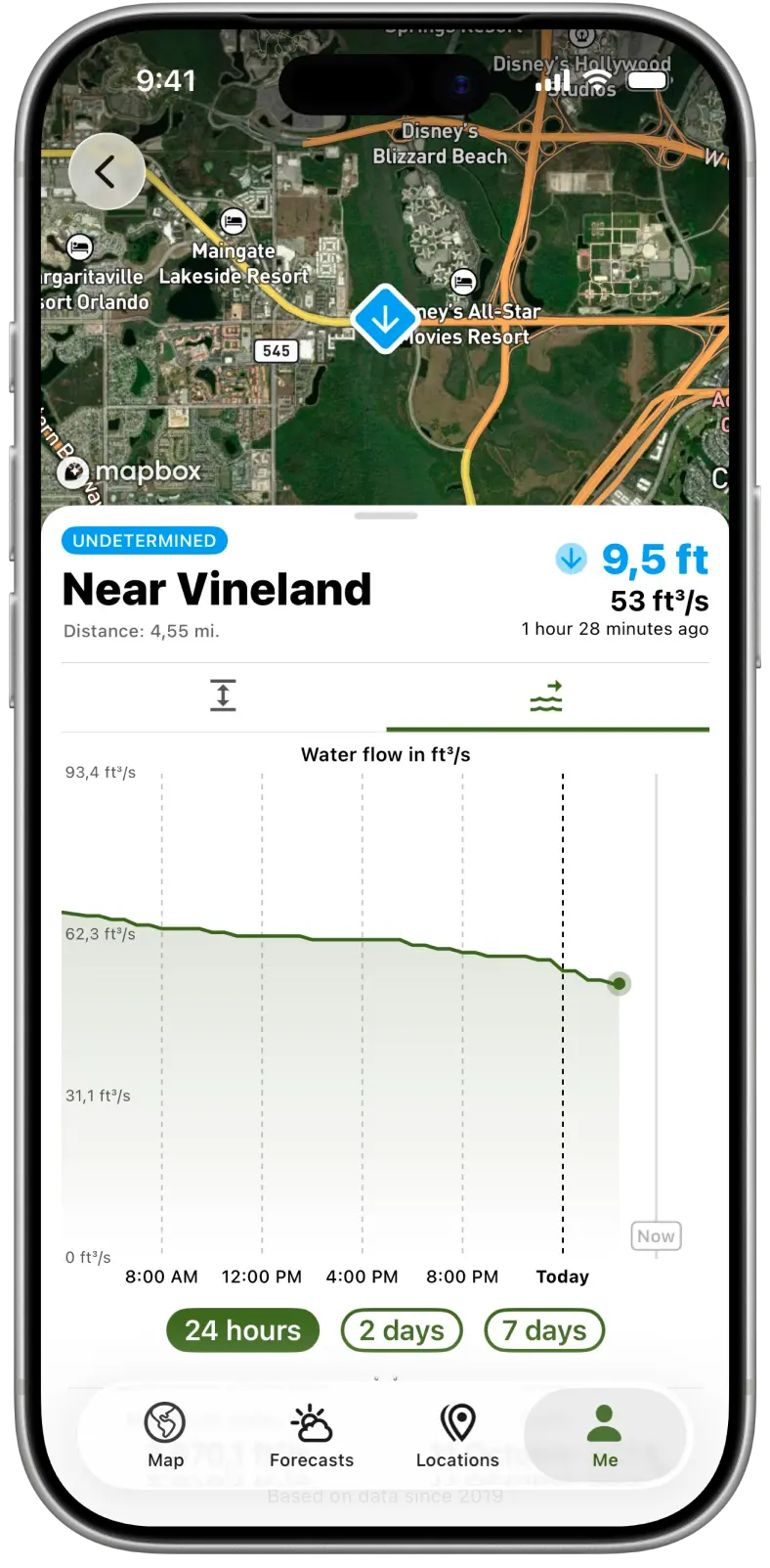
River flow and height at a glance
See the current water level and flow at stations near your hunting area, so you know what a crossing looks like before you get there.
Current levels are free. Premium adds the 7-day history, so you can see whether the river is rising or falling.
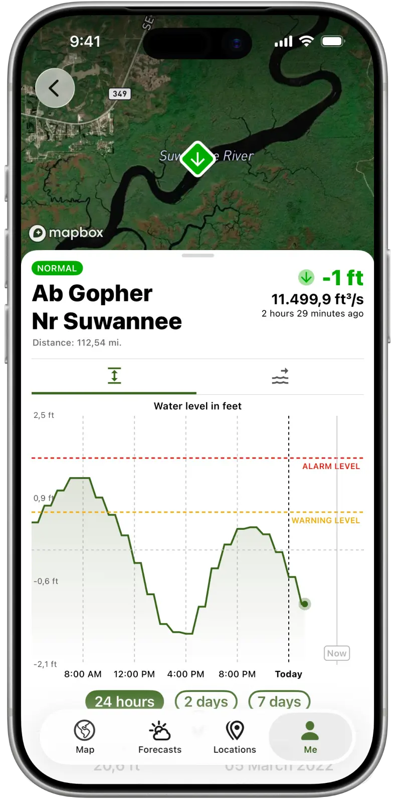
Know when the river is close to flooding
Where a station has flood thresholds, Hunting Points shows them with the current level, so you can tell how close the water is to flooding.
River data can be delayed or incomplete. Always judge the water on site before you cross.
Questions and answers
Is River Data free?
Current water levels are free. The 7-day history is part of Premium.
How many river stations are covered?
More than 35,000 river stations worldwide.
Does every station show flood thresholds?
No. Flood thresholds appear where they're available for a station.
Can I see whether the river is rising?
Yes, with Premium. The 7-day history shows how the level has changed over the past week.
Check the river before your next hunt
Free download. Current levels are free.
Get the app on your phone
Scan the code with your phone's camera, or choose your store.